Things to do in Kamas: The Gateway to the Uinta Mountains
A plain guide to Kamas, Utah: the Mirror Lake Highway, the High Uintas, a state park reservoir and a long list of outdoor days.
8 Oct 2026
Kamas is a small town in southwestern Summit County, about 42 miles east of Salt Lake City, at roughly 6,700 feet. About 2,100 people lived here at the 2020 census. Mormon pioneers settled it in 1859. The name comes from a flowering plant that Native Americans ate and that still grows in the valley. The town calls itself the Gateway to the Uinta Mountains, and that is the best reason to come.
Kamas itself is a quiet ranch and lumber town. We found no museums or sights in town that we could confirm from an official page. The mountains are the sight.
The Mirror Lake Highway
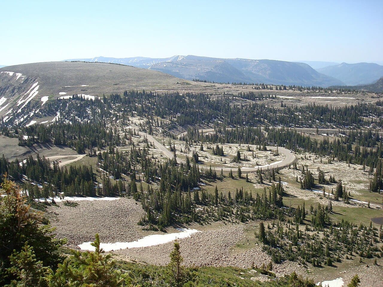
State Route 150, the Mirror Lake Highway, starts in Kamas and climbs into the Uintas. It runs about 55 miles to the Wyoming border near Evanston. It is a Forest Service scenic byway, and it takes its name from Mirror Lake, which it passes. It crosses Bald Mountain Pass at more than 10,000 feet.
The road is closed to cars in winter along a long middle stretch, though snowmobiles can use it. It usually opens again around Memorial Day, so check road status before you plan a drive.
The High Uintas
The High Uintas Wilderness covers 456,705 acres and became wilderness in 1984. It holds Kings Peak, the highest point in Utah, and many peaks over 13,000 feet. The climate is subalpine, with deep winter snow. Kamas is the nearest town, and the Mirror Lake Highway is the main road in.
The land is part of the Uinta-Wasatch-Cache National Forest, run by the U.S. Forest Service. A ranger district office is based in Kamas, which makes it a good place to ask questions before heading out on a long trail.
For families
A drive along the byway is the easiest family day, with stops to look at lakes and mountains. Save the long hikes in the wilderness for older, ready walkers, and check conditions first.
A short drive away
Rockport State Park, near Peoa, is built around Rockport Reservoir. People fish for trout and bass, boat, camp, hike, bike and kayak. It is an International Dark Sky Park, and the park takes steps to protect the night sky. Winter brings ice fishing.
The park has more than 100 campsites across five campgrounds, some developed and some primitive. The boat launch has floating docks, and you can rent boats, canoes, kayaks and paddleboards. Summer visitors water-ski and wake-board. There is also an archery range with life-sized animal targets, an old church building on the grounds, and snowmobile trails nearby in winter.
Jordanelle State Park, in Wasatch County, has three recreation areas on a big reservoir that the Provo River fills. It is a Dark Sky Park too, with boating, fishing, camping, hiking and biking.
The three areas each have a different feel. Hailstone has picnic areas, a campground and boating. Rock Cliff holds the nature center and the education programs, including a Junior Ranger program for children. Ross Creek is set up for day visits. You can also hike, ride horses, snowshoe and swim. The reservoir supplies drinking water to Wasatch, Utah and Salt Lake Counties, and the park is close to the Mirror Lake Highway, so it fits easily into a mountain day.
The Historic Union Pacific Rail Trail is a longer outing farther along the Weber River. It runs nearly 30 miles from the mountains near Park City to Echo Reservoir, by way of Wanship, Coalville and Echo, and it is Utah's first non-motorized rail trail. People bike, hike, ride horses and cross-country ski along it.
When the weather turns
We found little indoor to do in Kamas itself. On a wet day, Park City is the nearest larger town. In Coalville, the Summit County Courthouse is a stone building from 1903 and 1904 in the Richardson Romanesque style, and it is worth a look from the street.
Getting around
You will need a car. The Mirror Lake Highway begins at State Route 32 in Kamas, so the town is the natural starting point for a mountain day.
Good to know
Mountain weather changes quickly. Pack warm layers even in summer.
The highway closes in winter. Check the road before you leave.
Find local businesses
Planning a visit, or live nearby and need a hand with something? Browse the local businesses listed in the Park City and Summit County guide to find who serves Kamas and the towns around it.
Useful links
Businesses in Kamas in the Park City & Summit County guide
About Kamas: the town at a glance
Own a business in Kamas? Claim or add your listing, free
By Thomas Hassett and Eric Andrews, Local Business America
Photo: Glennfcowan, CC BY 3.0, via Wikimedia Commons.
Sources: Wikipedia, "Kamas, Utah" (https://en.wikipedia.org/wiki/Kamas,_Utah); Wikipedia, "Utah State Route 150" (https://en.wikipedia.org/wiki/Mirror_Lake_Highway); Wikipedia, "High Uintas Wilderness" (https://en.wikipedia.org/wiki/High_Uintas_Wilderness); Wikipedia, "Wasatch-Cache National Forest" (https://en.wikipedia.org/wiki/Uinta-Wasatch-Cache_National_Forest); Utah State Parks, "Rockport State Park" (https://stateparks.utah.gov/parks/rockport/); Utah State Parks, "Jordanelle State Park" (https://stateparks.utah.gov/parks/jordanelle/); Utah State Parks, "Historic Union Pacific Rail Trail" (https://stateparks.utah.gov/parks/historic-union-pacific-rail-trail/); Summit County, "History of the Summit County Courthouse" (https://summitcountyutah.gov/801/History-of-the-Summit-County-Courthouse). Wikipedia text is available under CC BY-SA.